جانیا:Arghandab River Valley between Kandahar and Lashkar Gah.jpg
ٱندازٱ اؽ پیش ساٛلٛ:۸۰۰ × ۵۳۲ پیکسل. هنیگۉپ نما کردنؽا: ۳۲۰ × ۲۱۳ پیکسل | ۶۴۰ × ۴۲۶ پیکسل | ۱٬۰۲۴ × ۶۸۱ پیکسل | ۱٬۲۸۰ × ۸۵۲ پیکسل | ۲٬۵۶۰ × ۱٬۷۰۳ پیکسل | ۴٬۲۵۶ × ۲٬۸۳۲ پیکسل.
جانؽا ٱسلی (۴٬۲۵۶ × ۲٬۸۳۲ پیکسل, ٱندازٱ فایلٛ: ۲٫۵۹ مگابایت, MIME نوع: image/jpeg)
چکسٱ
| تۉزی |
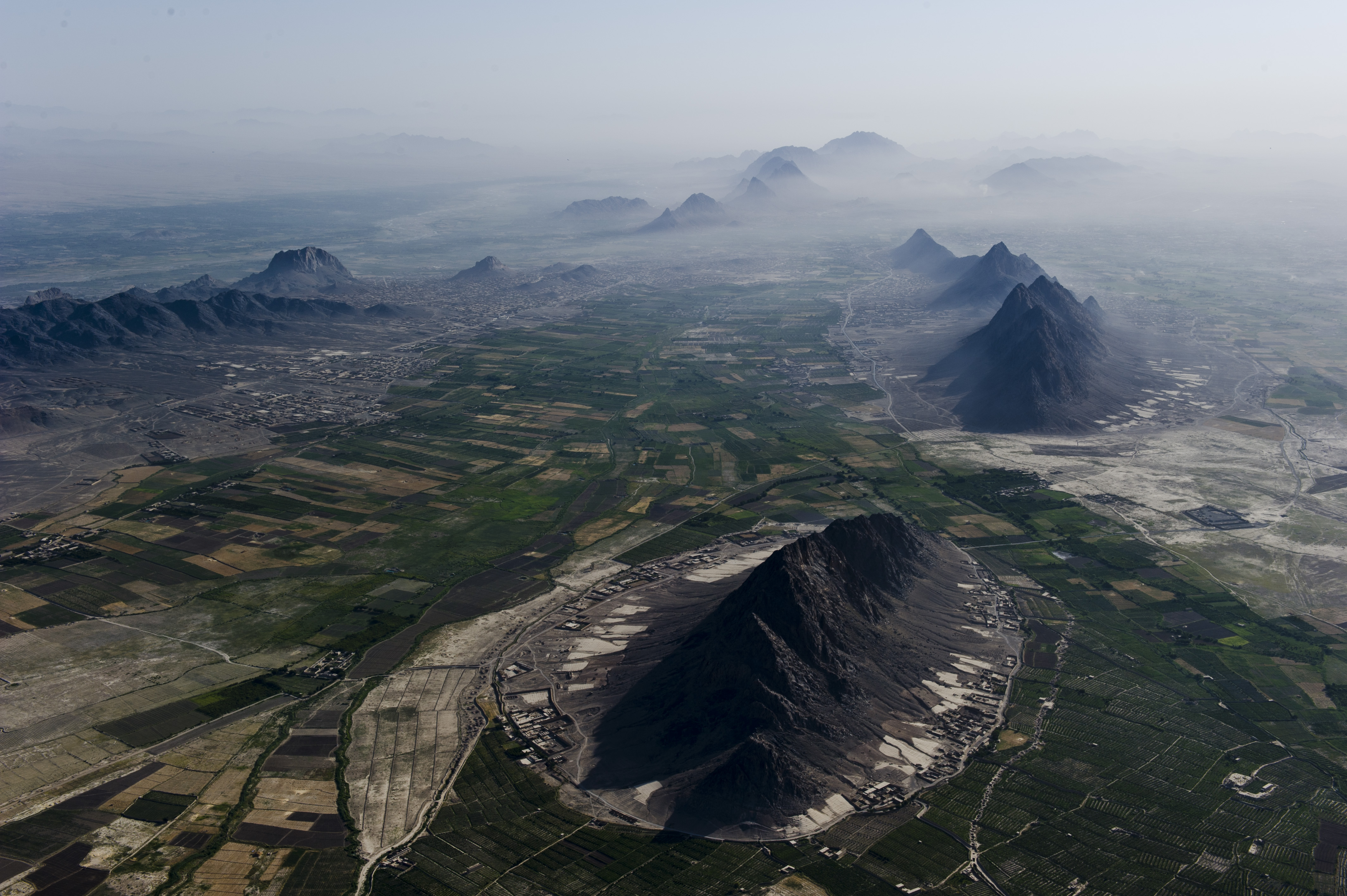
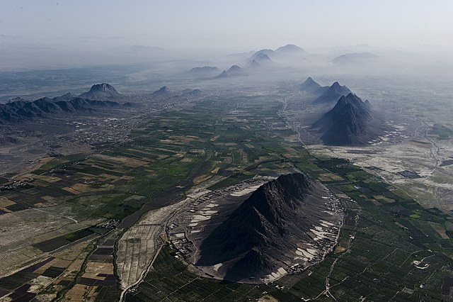
English: Mountains and plains just south-west of Kandahar city, which is beneath the haze on the right. Girowal Ghar mountain in the foreground. Arghandab River can be seen beyond the mountains at middle left. |
| گات | عکسبرداریشده در ۲۸ ژۊئٱن ۲۰۱۲ |
| سرچشمٱ | https://www.flickr.com/photos/usace-tas/7548074904/ |
| نڤیسیار | Mark Ray |
د هال ۉ بار لیسانس دار بیئن
This image or file is a work of a U.S. Army Corps of Engineers soldier or employee, taken or made as part of that person's official duties. As a work of the U.S. federal government, the image is in the public domain.
|
ڤیرگار جانؽا
ری ڤيرگارؽا بٱپۊرنؽت تا نۏسخٱ مٱربۊتاْ باٛینؽت.
| ڤيرگار/ڤٱخت | عٱسگ کوچک بیٱ | اۊیٱکؽا | کاریار | ڤیر ۉ باڤٱر | |
|---|---|---|---|---|---|
| تازٱ با | ۱۸ جۊلای ۲۰۱۲، ساعت ۰۵:۲۳ | | ۴٬۲۵۶ در ۲٬۸۳۲ (۲٫۵۹ مگابایت) | Officer | {{Information |Description={{en|Arghandab River Valley between Kandahar and Lashkar Gah}} |Source=http://www.flickr.com/photos/usace-tas/7548074904/ |Date=June 28, 2012 |Author=Mark Ray |Permission= |other_versions= }} =={{int:license-header}}== {{PD-... |
ڤ کار گرتن جانؽا
ایچاْ هیچ بٱلگاٛیی سی هوم پیاٛڤٱن بیئن ڤا اؽ جانؽا نؽ